


Global models for regional studies
PDF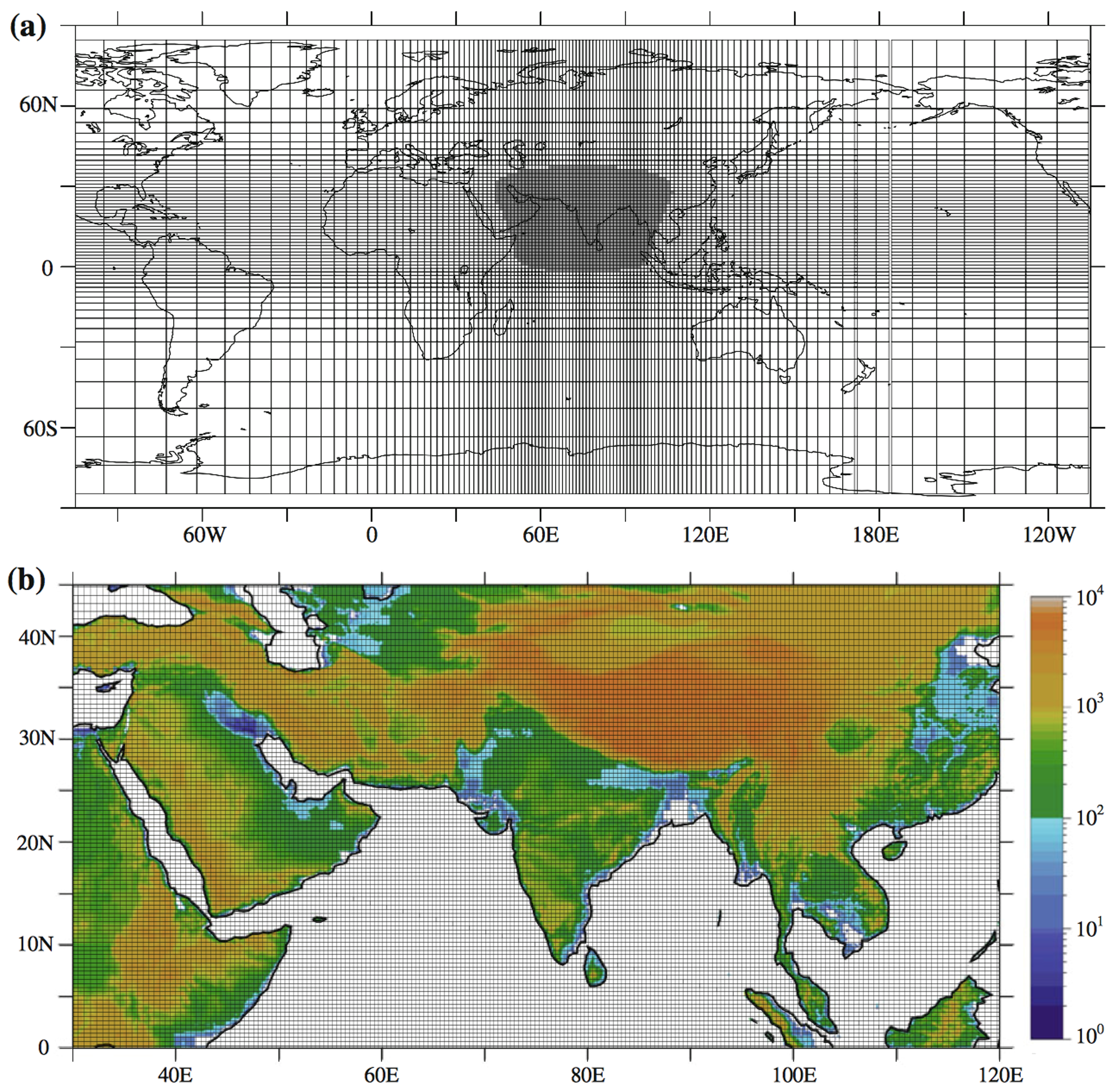
- These models integrate different components coupled together, usually an oceanic circulation model and an atmospheric circulation model, the latter usually including a scheme for continental surfaces.
- New components are regularly added to these models, which are now often defined as “Earth System Models” (ESM).
- These complex models now typically include components to represent sea ice, polar ice caps, or biogeochemical cycles to describe atmospheric aerosols or the carbon cycle for example, and thus estimate their interactions with the climate machine.
Despite the availability of more and more powerful computing platforms, the high numerical “cost” of the experiments produced with these models imposes limited spatial resolutions, typically reaching a few hundred to fifty kilometers in 2021. This type of resolution is too coarse to reproduce the spatio-temporal variability of temperature, precipitation and snow cover observed in mountain regions. One way to circumvent this limitation is to use a variable resolution grid, zooming in on the region of interest, as illustrated in Figure 1 [1], where the 35 km resolution allows to represent reliefs reaching 5000 to 6000 m a.s.l. in the high mountains of Asia.
Another method is to use limited-area models with even finer resolutions, on the order of a few kilometers, but which produce simulations affected by their boundary conditions, which are themselves produced with global models. Even with extremely fine resolution, however, it is not possible to describe all local processes in a climate model. For this reason, these models incorporate “subgrid” parameterizations, i.e. relationships that allow empirical description of subgrid-scale processes, such as atmospheric convection or snow cover in mountain regions.
Notes and references
Cover image. General circulation model applied with stretched resolution and zoomed in on the high mountains of Asia [35]. For clarity, every fourth grid point is shown in figure a, where the shaded area corresponds to 35 km resolution. The surface elevation is shown on a regional scale in (b). [Source: figure reproduced from Sabin et al, ref [1]]
[1] Sabin, T.P., Krishnan, R., Ghattas, J., Denvil, S., Dufresne, J.L., Hourdin, F. and Terray, P., 2013. High resolution simulation of the South Asian monsoon using a variable resolution global climate model. Climate dynamics, 41, pp.173-194.


