


The mass balance of glaciers
PDFThe mass balance is the difference between the snow that has accumulated (accumulation) and the snow and ice that has melted or disappeared in the course of a year (ablation). A glacier in equilibrium with the climate has a mass balance of zero on average, and a glacier in disequilibrium with the climate has a mass balance that is farther from zero the farther it is from its equilibrium state.
1. How is the mass balance of glaciers measured?
The glacier mass balance is the integral of all mass fluxes across the glacier contour. The mass balance ΔM, expressed in kg or m3 water equivalent (w.e.), is defined as follows [36]: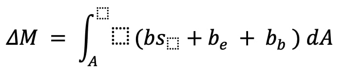
Where A (m2) is the map view area of the glacier, bs, be and bb are the surface mass balances, englacial and basal, expressed in kg m-2. For most glaciers, the dominant term in the integral is the surface mass balance, and thus the glacier-scale mass balance can be written:
![]()
The geodetic method aims to measure the total volume change of the glacier by repeated surveys of its surface topography. The most common method is to differentiate between two digital terrain models (DTMs) obtained either by airborne photogrammetry or by satellite topographic missions. In this case, the total volume change of the glacier (ΔV in m3) is expressed as follows:
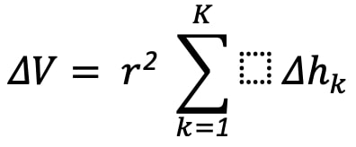
Where r2 is the area of a pixel (in m2), K is the number of pixels over the glacier area, and Δhk (in m) is the change in thickness of each pixel. The change in volume is then converted to a change in mass by making an assumption about the density, which introduces an uncertainty of about 10%.
2. The example of the Mera glacier
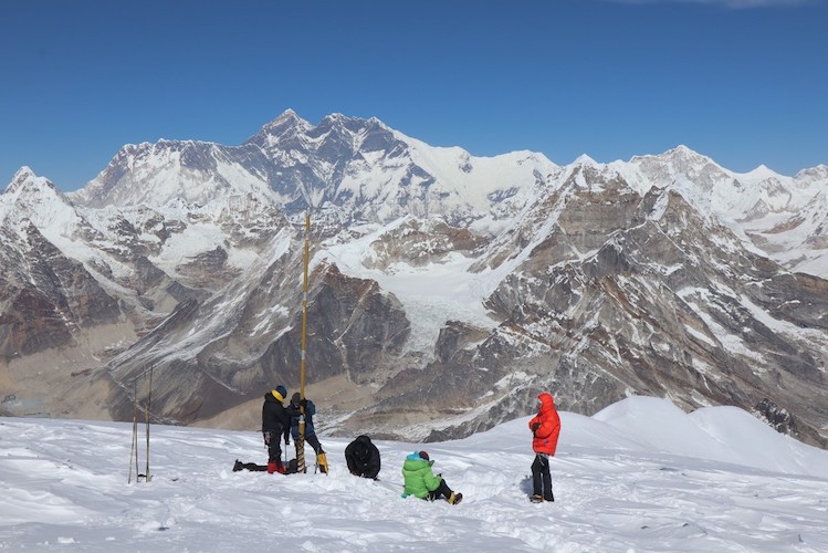
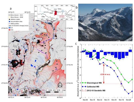
To illustrate, let us take the example of the Mera Glacier, located about 30 km south of Mount Everest in Nepal and which has been monitored for mass balance since 2007. Figure 3 shows the observation network deployed on the Mera glacier in Nepal, which flows from the summit of the same name at 6500 m a.s.l. to its front at 4900 m a.s.l..
The mass balance is determined twice a year from measurements of emergences from regularly distributed ablation stakes in the lower part of the glacier below 5600 m, as well as from measurements of accumulation by coring at various altitudes, up to the top of the glacier. The area-weighted average of the mass balance obtained at each ablation or coring site at each elevation is the total mass balance. Between 2007 and 2021, the Mera glacier lost mass, -0.37 ± 0.22 m e./year on average, but with high interannual variability. The year 2017-18 showed the most negative mass balance of the series with -0.92 ± 0.16 m e./year, related to a marked deficit of precipitation, while 4 years saw the glacier slightly gain mass, sometimes thanks to record precipitation as it was the case during the passage of typhoon Phailin between 13 and 15 October 2013 [37].
Notes and references
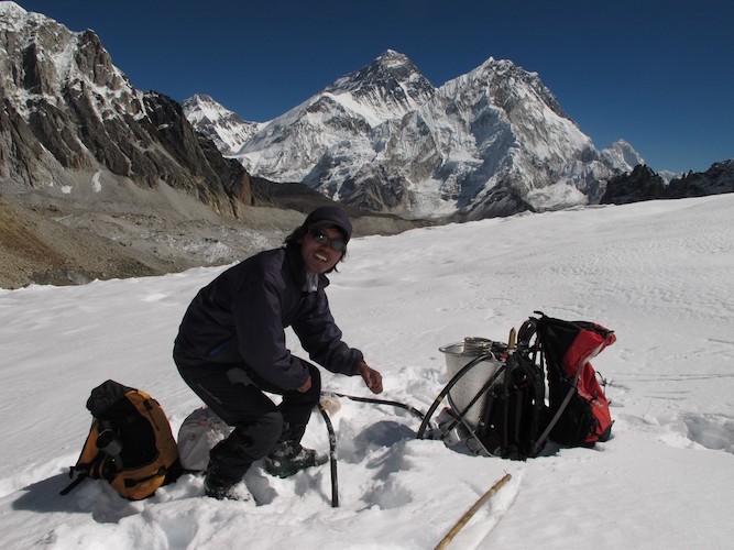
Cover image. [Source: © Bruno Jourdain]
[36] Cuffey, K. M., and Paterson, W. S. B.: The physics of glaciers, Fourth ed. by Academic Press Inc, Amsterdam, 2010
[37] Wagnon P, F Brun, A Khadka, E Berthier, D Shrestha, C Vincent, Y Arnaud, D Six, A Dehecq, M Ménégoz, V Jomelli. Reanalysing the 2007-19 glaciological mass balance series of Mera Glacier (Nepal, Central Himalaya) using geodetic mass balance, J. Glaciol, 67(261), 117-125. https://doi.org/10.1017/jog.2020.88, 2021